
Forest HILL
California
Video
1
LOCATION
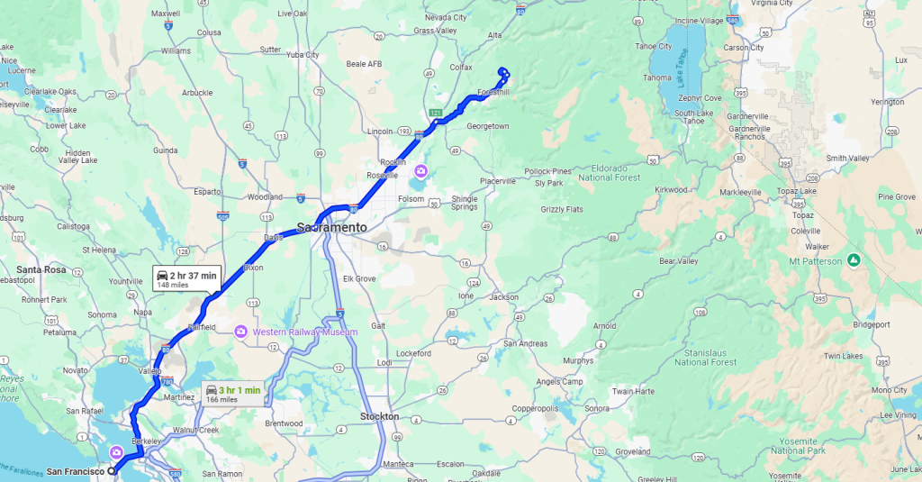
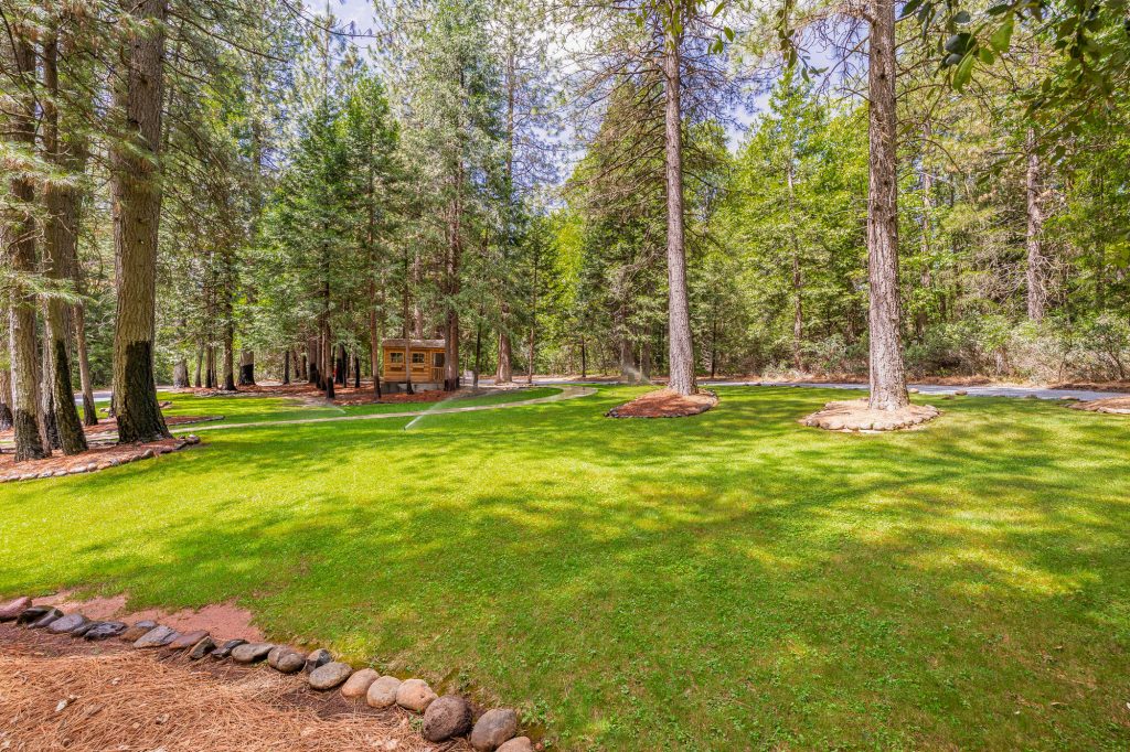
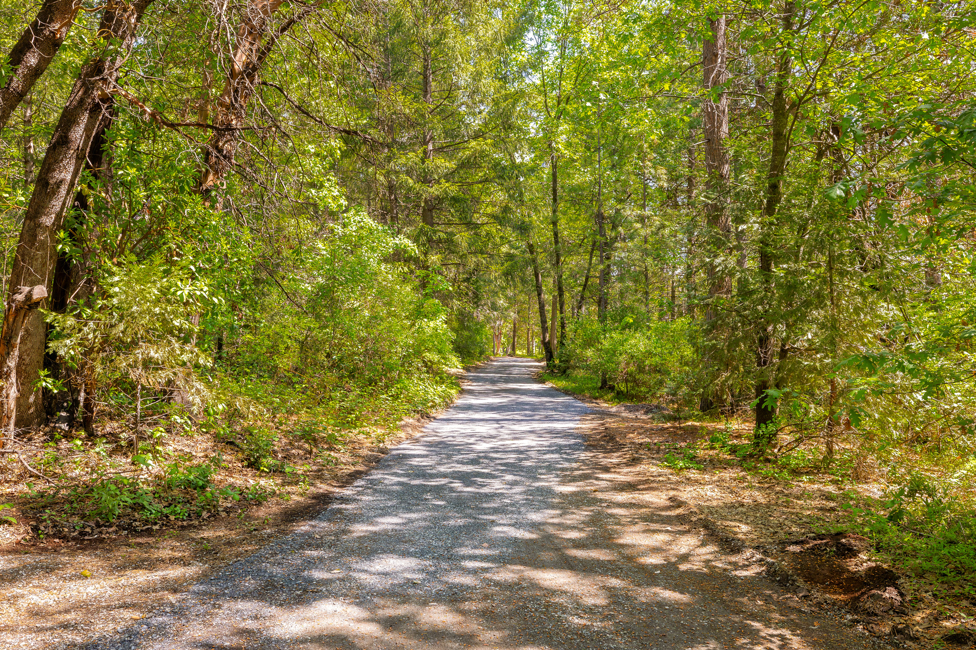
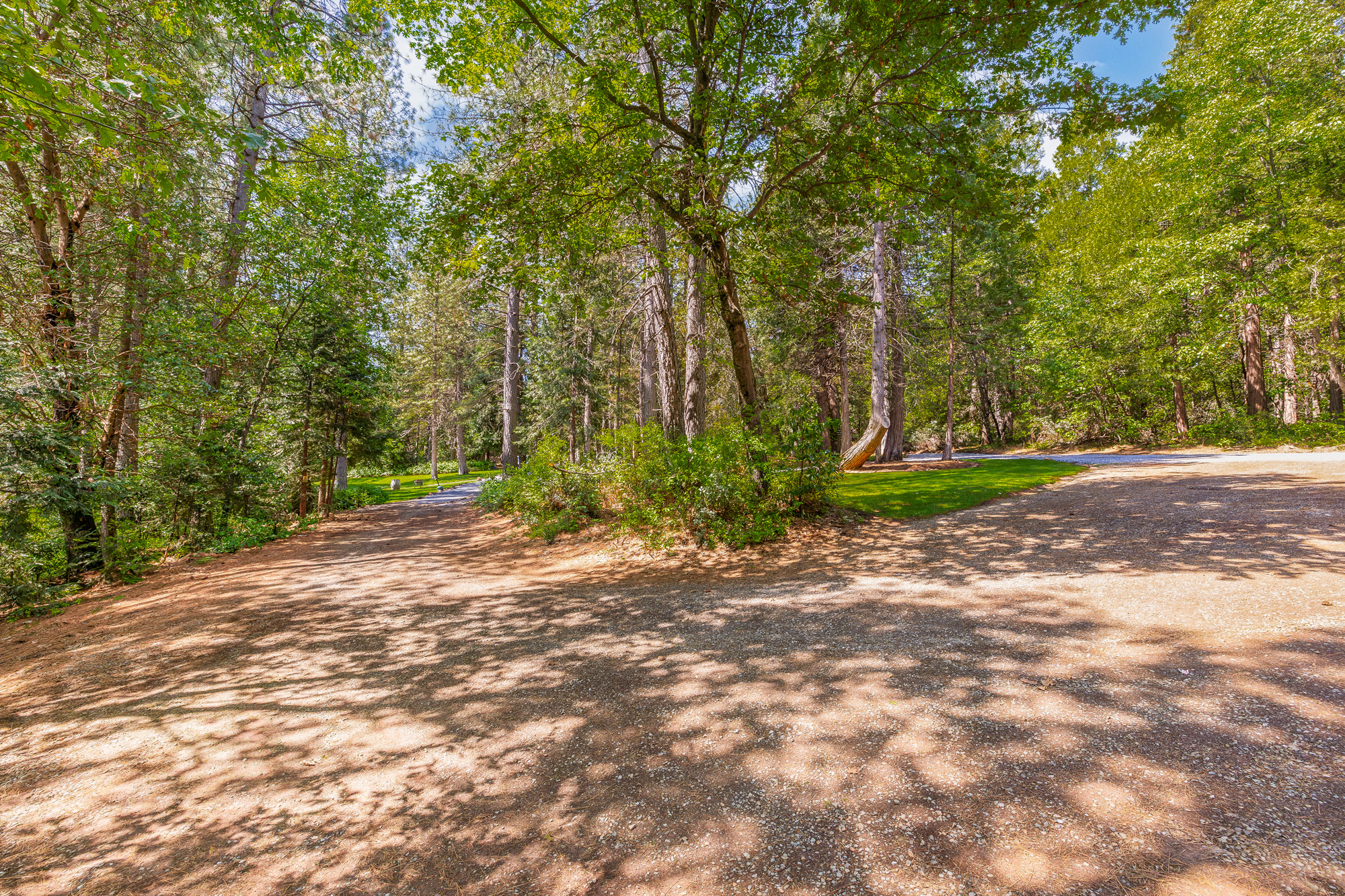
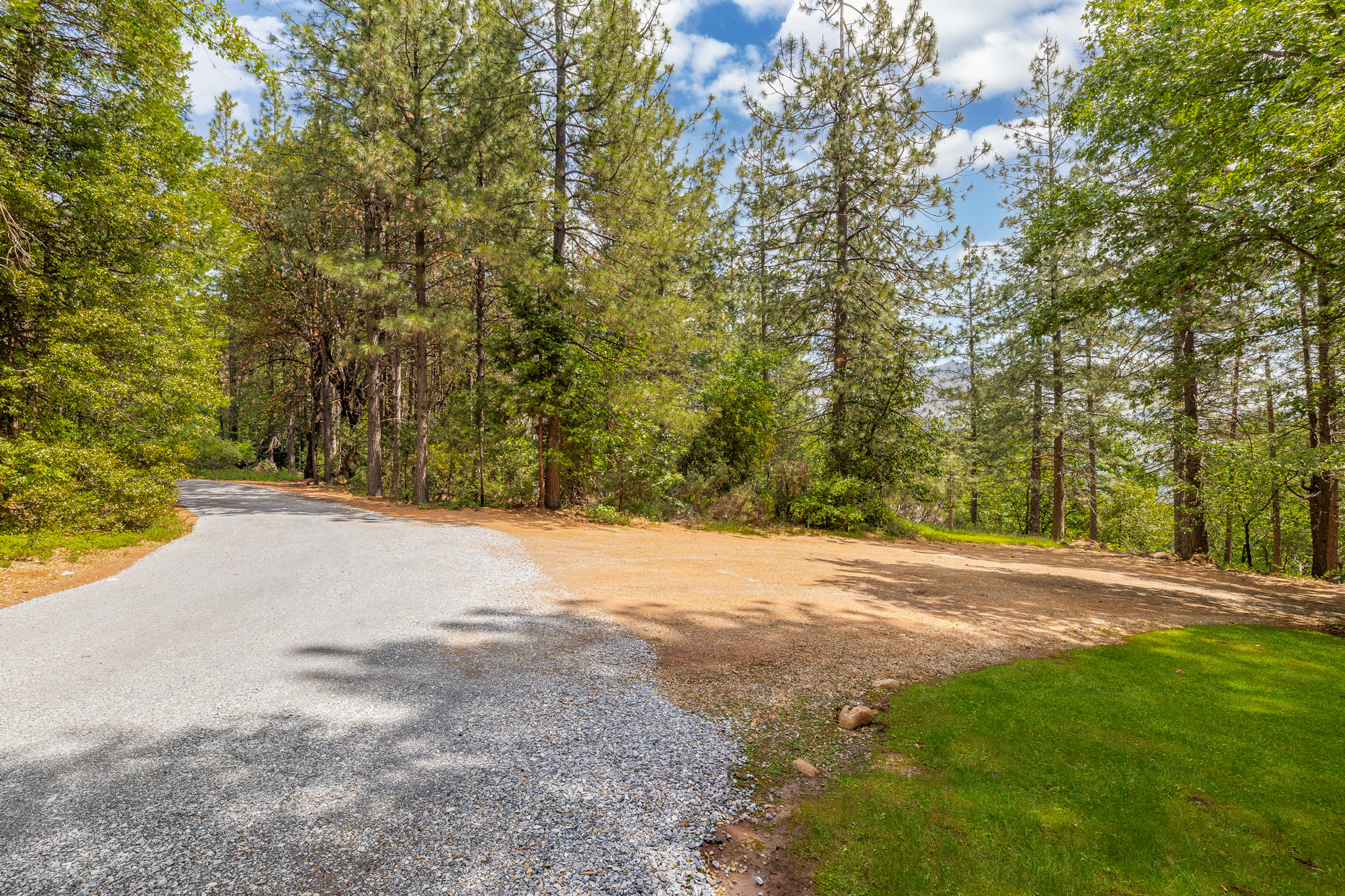
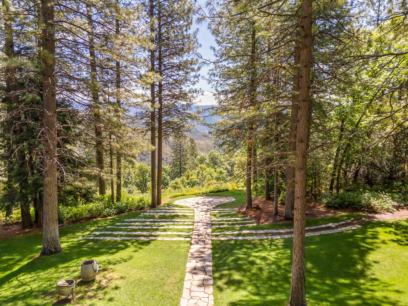
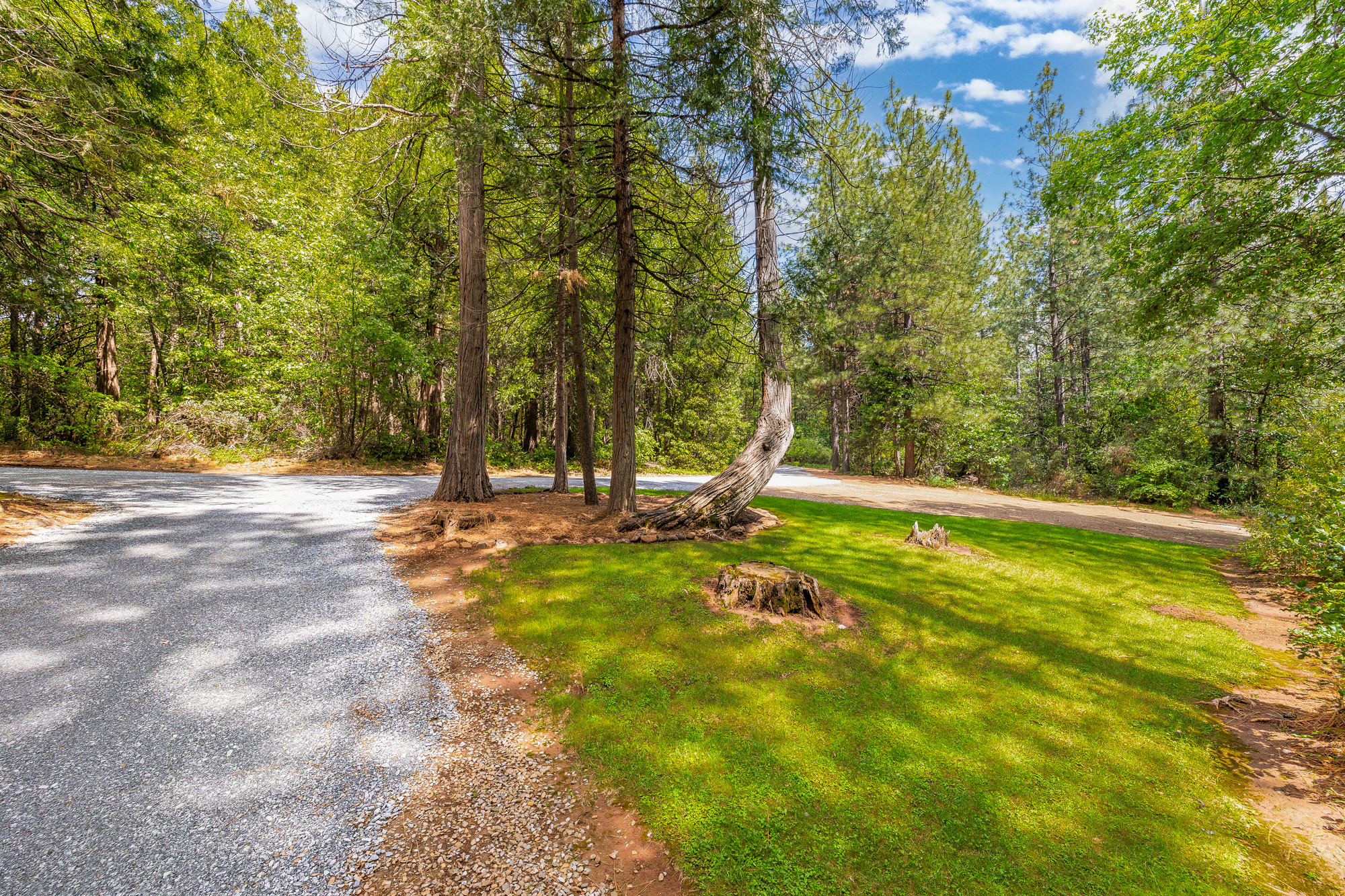
Foresthill is a rare gem nestled in the lower Sierra Foothills of Placer County, just 50 minutes east of Sacramento. Spanning approximately 1,200 hectares, the property offers a blend of gentle slopes and dramatic ridgelines with panoramic views stretching up to 50 kilometers. Its location balances tranquility and accessibility—only a short drive from iconic destinations like Lake Tahoe, Squaw Valley (site of the 1960 Winter Olympics), and Auburn’s private airport, while being adjacent to the charming unincorporated town of Foresthill.
The area enjoys a mild four-season climate and is already equipped with critical infrastructure including roadways, water from an 8.6 million m³ reservoir, electricity via an adjacent substation, and general plan approvals for residential and commercial development. Whether envisioning a high-end residential enclave, a retirement community, or a resort destination, Foresthill is a rare investment opportunity set against the backdrop of natural beauty and long-term growth.
The property is about approx. 1/10th of the size of the city of San Francisco. For those familiar with the San Francisco Peninsula, an apt description would be about approx. 3/4th the size of Hillsborough. The Foresthill property is just shy of approx. 1/6th the size of Hong Kong island. It’s about approx. 2.5 hours drive from San Francisco International Airport

Foresthill History
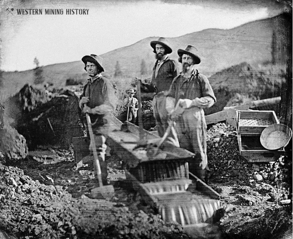
Forest Hill was first settled when the Forest House hotel and trading post was built after gold discoveries in 1850. The post office was established in 1859 under the name “Forest Hill”, but was changed to “Foresthill” in 1895 for reasons that are difficult to determine.
Foresthill was one of the largest towns in Placer County. By the late 1850s it boasted hotels, stores, banks, saloons, and numerous homes and other structures. The productive hard-rock mines of the area would ensure that the town remained viable for many decades.


An October, 1859 edition of the Daily Alta California provided a glowing report of conditions at Foresthill at the time: “Forest Hill is, for its size and age, as fine a village as I met in my travels. Its citizens are highly favored with good prospects, in addition to the enormous amount of gold already obtained.”
2
Foresthill
Goldmine
Foresthill has a significant gold mining legacy rooted in the California Gold Rush.
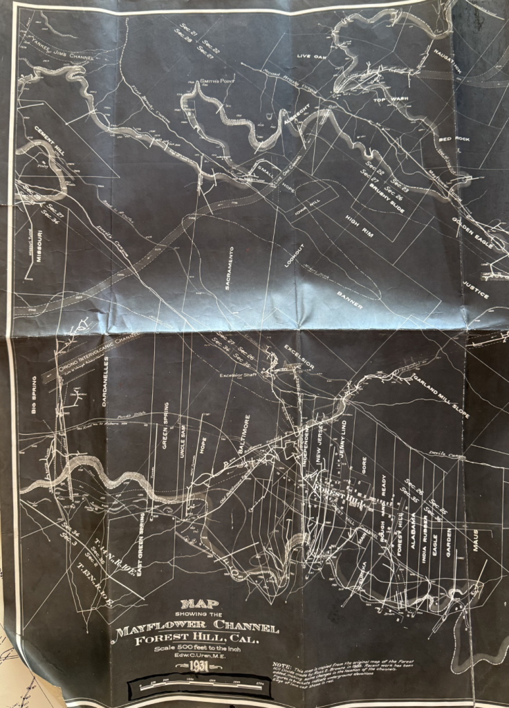
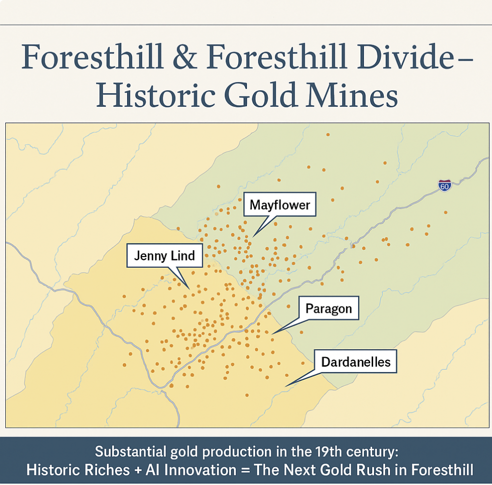
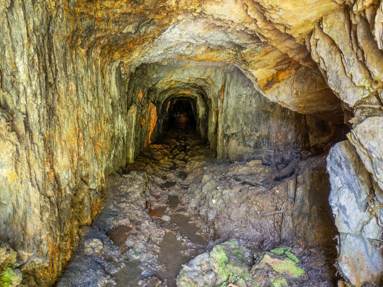
Foresthill Mining District, California holds three significant drift mines —
Baltimore , Dardanelles, and Mayflower — all cited in historic records for substantial production or remaining gravel in the Foresthill Channel. Baltimore reportedly has [2 million cubic yards of un-mined gravel. Historic yields in this channel ranged from [0.008 oz/yd3] to [0.18 oz/yd3], representing a potential in-situ value in the tens of millions to over a billion dollars at current gold prices. We are seeking qualified partners for a Phase I evaluation to confirm volume and grade, with options for [purchase or profit-sharing arrangements.
To develop this opportunity requires modern technology (a completely subterranean operation), political savvy, and financial resources.
Baltimore Mine
The Baltimore is an underground drift mine cited in the 1927 State Mineralogist report as having ~2 million cubic yards of unmined Foresthill Channel gravels. No historic production figures are recorded, but its proximity to prolific producers (New Jersey, Jenny Lind, Independent) suggests high potential. – Low-end (0.008 oz/yd3): ~16,000 oz → ~$54 million at August 2024 prices – High-end (0.18 oz/yd3): ~360,000 oz → ~$1.22 billion at August 2024 prices
Dardanelles Mine
About 3,700 feet west of the Baltimore adit, the Dardanelles was worked by both drift mining and hydraulicking. Historic production is reported at $2,000,000 (~125,000 oz at $16/oz). Remaining gravel volume is unquantified, but its explicit mention in the 1927 State Mineralogist report indicates significance.
Using a conservative 10–40% non-recovery range, the remaining potential is: – 14,000–56,000 oz → ~$48 million to ~$190 million at August 2024 prices
Mayflower Mine
Roughly 2 miles northeast of Baltimore, the Mayflower was a major Foresthill Channel producer with historic output of $1,000,000 (~62,500 oz at $16/oz). Under a 10–40% non-recovery range, remaining potential is: – 7,000–28,000 oz → ~$24 million to ~$95 million at August 2024 prices
The Baltimore and Dardanelles drift mines are cited in the 1927 State Mineralogist report for substantial unmined Foresthill Channel gravels. The Baltimore is estimated at 2,000,000 cubic yards; the Dardanelles, while unquantified, warranted specific mention. Historic yields range from 0.008 oz/yd3 (hydraulicking at Dardanelles) to 0.18 oz/yd3 (drift-mined gravels in the Foresthill Channel through both mines). At current gold prices (~$3,400/oz), that equates to $54M to $1.22B in potential in-situ value (Baltimore only).
Baltimore & Dardanelles Mines –
Gold Recovery Opportunity Foresthill Mining District, Placer County, California – Sierra Nevada Foothills
The Baltimore and Dardanelles drift mines are cited in the 1927 State Mineralogist report for substantial unmined Foresthill Channel gravels. The Baltimore is estimated at 2,000,000 cubic yards; the Dardanelles, while unquantified, warranted specific mention. Historic yields range from 0.008 oz/yd3 (hydraulicking at Dardanelles) to 0.18 oz/yd3 (drift-mined gravels in the Foresthill Channel through both mines). At current gold prices (~$3,400/oz), that equates to $54M to $1.22B in potential in-situ value (Baltimore only).
1. Executive Summary
The Baltimore and Dardanelles underground drift mines are located in the historic Foresthill Mining District of Placer County, California, within the Foresthill Tertiary Channel system. Both mines are cited in the 1927 California State Mineralogist’s Gravels of the Middle Fork of the American River.
– Baltimore Mine – Estimated 2,000,000 cubic yards of unmined channel gravels.
– Dardanelles Mine – Remaining gravel volume not quantified; presumed significant due to explicit mention in
the report. Historic yields in the district range from 0.008 oz/yd3 (hydraulicking at the Dardanelles) to 0.18 oz/yd3
(drift-mined gravels in the Foresthill Channel, which flows through both mines). At August 2025 gold prices (~$3,400/oz), the Baltimore alone represents a potential in-situ gross value between $54 million and $1.22 billion, depending on grade.
We are seeking a qualified mining partner to fund and execute a Phase I program to confirm gravel volume and grade, with the option to negotiate purchase or profit-sharing terms.
2. Historic Production Context
Mine Historic Production Value* Gold Price at TimeApprox. Ounces Notes
Baltimore N/A – – Estimated 2,000,000 yd3 of unmined channel gravels
Dardanelles $2,000,000 $16/oz ~125,000 oz Mix of drift mining and hydraulicking
Mayflower $1,000,000 $16/oz ~62,500 oz Located ~2 miles NE, also on Foresthill Channel
* Historical figures from state and mining district records; some are third-party historical estimates.
3. Remaining Resource Potential
Using a 10–40% non-recovery range — consistent with conservative estimates of residual gravels in similar drift mines — and applying yield assumptions for Baltimore based on historic grades*:
– Baltimore – 2,000,000 yd3 at 0.008–0.18 oz/yd3 = 16,000–360,000 oz (*).
– Dardanelles – ~14,000 to 56,000 oz remaining.
– Mayflower – ~7,000 to 28,000 oz remaining.
– Combined Multi-Mine Potential – 37,000 to 444,000 oz.
4. Key Advantages for Modern Evaluation
1. High-Value Target – Documented unmined gravels in one of California’s most productive Tertiary channels.
2. Historic Grade Variability – From low-grade hydraulicking yields to high-grade drift-mined pay.
3. Infrastructure Access – Road network, grid power, and water resources in place for rapid mobilization.
4. Potentially Preserved Tunnels – If intact, may reduce cost and time to access gravels.
5. Proximity to Proven Producers – Baltimore adjoins historically high-yield mines (New Jersey, Jenny Lind,
Independent).
5. Phase I Objectives
1. Quantify Remaining Gravel – Volume and distribution in target channels.
2. Determine Grade – Representative sampling to establish economic potential.
3. Evaluate Access – Assess condition of existing workings or define drilling approach.

3
Foresthill
History & Facts
Foresthill has a significant gold mining legacy rooted in the California Gold Rush.
Prior to European settlement , the indigenous Maidu people followed the seasons, migrating from the lower Foresthill Divide to the Sierra Nevadas. Gold was discovered in California in 1849, shortly thereafter gold was discovered in Foresthill , California. At one time the Foresthill Divide housed one of the larger towns in the state of California. The property on offer is the historic Mayflower Mine, one of the largest in California. With the prohibition of hydraulic mining, the population of Foresthill declined. Over the next century and a half, Foresthill hosted several lumber mills. A lumber industry provided for a thriving economy. With the exhaustion of the timber harvests, the lumber economy declined . Currently, the closest lumber mill is 50 miles. Today Foresthill is home to those who wish to have a mild four season climate, be close to services, and enjoy the recreational opportunities that are in abundance. Foresthill is within commuting distance of Auburn, Roseville, and Sacramento.


Foresthill Today
FACT SHEET: POPULATION – PREDICTED VS. ACTUAL. The County’s environmental analysis assumed a population growth rate of 2% per year. The actual growth rate between the years 2000 to 2020 was 0.55%. As a result, a project on the Foresthill site can be substantially larger than the concept plan of 2,213 units (1700 units of which would be age restricted) that had been studied in the EIR without negatively impacting any mitigation measures listed in the certified EIR. WATER. The Foresthill Public Utility District (PUD) did a build-out analysis of the service capacity of the Sugar Prime Reservoir and determined that in its present state it could support nearly 14,000 residents. At the present rate of growth that population would be reached in the last two decades of the 22nd century (not a misprint). The analysis assumed that 533 of those units would be built on the Foresthill project site (about 1,300 residents). For water supply planning purposes, the State of California Senate Bill 610 (SB610) guideline is 20 years. If population continues to grow at the same rate it did between 2000 and 2020, the population in 2045 would be roughly 7,000 inhabitants, indicating substantial room from a water perspective for a much larger retirement community that the 3,000 residents envisioned in the Forest Ranch concept plan in FDCP certified EIR. Note: Though apparently not necessary, the usable capacity of Sugar Pine Reservoir can be increased by two-thirds through the installation of radial gates and the flooding of an additional 44 acres. The current dam was designed for radial gate installation. TRANSPORTATION. The only issue identified during the FDCP EIR process was a potential deterioration of service levels during commute hours. A study by Economic and Planning Systems (EPS) estimated post construction on-site employment of 200 persons for the retirement portion of Foresthill concept plan (1700 units). In addition, EPS predicted an additional 770 jobs would be created throughout Placer County. Though not part of the report, the author and I had a discussion to determine how many of those 970 jobs would end up in Foresthill. Jointly reviewing the estimated number of jobs by sector (Table F-8 in the report), it appeared that around 500 of the 970 jobs would be in Foresthill itself.
Local employment by local residents in lieu of commuting off the hill would have a positive effect of reducing the number of commuters during the rush hour. On the flip side, a small portion of residents of the active adult retirement community still would be working. I had read somewhere that the percentage was around 12%, with half working from home. Which means about 6% would have some type of commute. Some obviously would commute locally in Foresthill, some off the hill, some during commute hours and some not. On balance, the number of local jobs created resulting in the reduction of commute hour traffic should outweigh the few retirees who might utilize the road during commute hours. As a result, any increase in the size of a retirement community should not have a negative impact on commute hour traffic. Of course, the specifics of any proposal would have to be analyzed. In addition to the above, the four-fold over-estimation in the FDCP EIR indicates that, at the present time, mitigation measures would not be necessary for a very long time to come. ECONOMIC. As noted in the transportation section, about 500 jobs would be created locally, fulfilling the FDCP’s stated high priority goal of increasing employment on the divide. There are a handful of active adult retirement communities located approximately 20 miles from the nearest urban areas. Economic development in Foresthill would be expected to mirror their experience. For example, in Sequim, Washington, a couple dozen part-time medical specialties opened locally to cater to the senior community. Most, according to the local librarian, operated one to two days a week. Of course, this benefits the non-retiree parts of the community as well. FISCAL. EPS also evaluated the fiscal impacts of Foresthill conceptual plan. Given that seniors commit very few crimes, it is not surprising that the report indicated a net fiscal surplus to the County. SEWAGE. Appendix E of the FDCP requires a wastewater treatment plant with enough capacity to serve both the foresthill project as well as the commercial areas of downtown. The growth of Foresthill commercial area predates many of the current regulations related to sewage disposal. Inclusion of a wastewater treatment plant would rectify potential problems. FIRE. One of the advantages of a master plan community on the Foresthill project site is that dangers from wildfires can be mitigated. Communities built to fire resistance standards and maintained to enforce the standards have been shown to be spared from wildfires. One example is the Crosby subdivision area of Rancho Santa Fe, California. The 2007 WITCH fire burnt everything around this particular subdivision. No homes were lost in the Crosby subdivision. (Source KQED)

What are the “ancient river gravels”?
Why is this important at Foresthill?
Key geological points about Foresthill gravels
Modern relevance
1) Where the ancient channel runs (Foresthill Divide, Placer County)
Landmarks you’ll see in historical geology/mining write-ups:
If you’re standing on the Divide today, you’re literally on a broad ridge of ancient river bed between the North and Middle Forks of the American River. Sierra Nevada GeotourismWikipedia
2) Gold endowment & “what’s left”
What’s known (historic extraction):
What might remain (realistic view):
Back-of-envelope framework (how geos estimate “leftover”):
Because pay is highly streaky, any “total remaining ounces” would carry big error bars. Still, the geology and history support the common miner’s adage up there: some gold remains where mining stopped, especially in deep, capped, or awkward segments that weren’t practical with 19th-century methods.
Handy primary references
Presented By


John Pang
Title
Owner / Operating Principal
info@foresthill.com
Company
Realty One Group Extreme
Web
foresthill.com
Phone
(650) 699-2838
License #
DRE # 02208098 – Office DRE # 02226794